INSTITUTE OF ENVIRONMENTAL STUDIES
& WETLAND MANAGEMENT (IESWM)


Since inception, the Institute has been striking a balance between man and the environment. With the passage of time, IESWM has expanded its activities in the field of water quality monitoring, soil and water pollution research, investigation studies of the agricultural produce and fishes which are commercially distributed, harvesting of rainwater (roof top), municipal waste management, hazardous waste management, biodiversity assessment and conservation, and so on. Till date, the institute has completed more than 30 projects successfully along with the installation of the rainwater harvesting system in different government and private schools, colleges and universities in different districts of West Bengal.

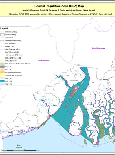
The Ministry of Environment, Forest & Climate Change (MoEF&CC), GoI, with a view to ensure livelihood security of the local community through sustainable development, to conserve and protect the environment, maintain coastal integrity, mitigate natural hazards and disasters by addressing climate change issues, promulgated implementation of Coastal Regulation Zone (CRZ) in 1991 which was further amended in 2011 and 2019 under the provision of Environment Protection Act, 1986.

The objective of the Integrated Coastal Zone Management (ICZM) Project is to assist Government of India (GoI) in building national capacity for implementation of comprehensive coastal management approach in the country, and piloting the integrated coastal zone management approach in states of Gujarat, Orissa and West Bengal. There are four components to the project, the first component being national ICZM capacity building. The national component will include mapping, delineation and demarcation of the hazard lines, and delineation of coastal sediment cells all along the mainland coast of India. The second component is the piloting ICZM approaches in Gujarat.
